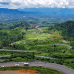
Prey Veng, meaning “Long Forest” in Khmer, is a peaceful province located in southeastern Cambodia. Although its name suggests a dense woodland, much of the forested landscape has been converted over the past few decades into fertile farmland. Today, the province is best known for its agricultural output and proximity to key transport routes, especially National Highway No. 1, which connects Phnom Penh to Ho Chi Minh City in Vietnam.
Despite its low profile in tourism, Prey Veng is one of the country’s more densely populated provinces, situated along the eastern banks of the Mekong River. Its strategic position once made it a hub of early civilizations. Today, its quiet towns, historical remnants, and rice-rich countryside offer a glimpse into authentic rural Cambodia.
Provincial Capital
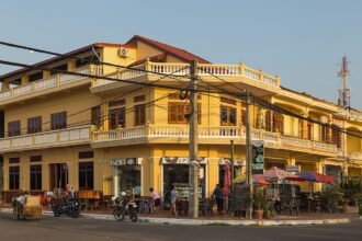
The provincial capital, also named Prey Veng, lies on National Road No. 11, serving as a connection between Neak Luong and Kampong Cham. The town itself has a serene charm, with colonial-era buildings hinting at a more vibrant past. A large seasonal lake on the town’s western edge becomes arable land during the dry months (March to August), allowing local farmers to cultivate rice on its nutrient-rich soil.
For travelers seeking an off-the-beaten-path destination away from busy circuits, Prey Veng offers an ideal stopover—particularly en route to or from Vietnam or Kampong Cham.
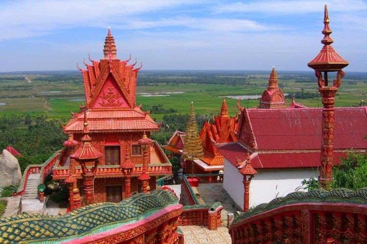
Historical Significance
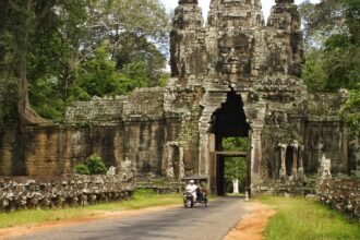
Prey Veng played an important role during pre-Angkorian times, particularly in the Ba Phnom area, which is believed to have been one of Cambodia’s earliest and most populated regions. While modern development has overtaken much of the ancient landscape, the area’s historical importance remains significant in Cambodian heritage.
Geography
Covering 4,883 square kilometers, Prey Veng lies in Cambodia’s southern lowlands. It is bordered by:
- Kampong Cham to the north
- Kandal to the west
- Svay Rieng to the east
- Vietnam to the south
The province is primarily composed of flat plains, ideal for rice cultivation and other agricultural activities. Two major rivers—the Mekong and Tonle Bassac—flow through the province, providing irrigation, transport routes, and fishing opportunities.
Population
As of 2007, Prey Veng had a population of 1,063,494, making up approximately 7.64% of Cambodia’s total population. The gender distribution includes:
- 502,671 males
- 560,823 females
The province has a population density of 217.8 people per square kilometer. A significant majority of the population depends on agriculture and fisheries:
- 80.54% are engaged in farming
- 13.72% in fishing
- 4.35% in trade
- 1.39% are employed in public service
Climate
Prey Veng shares Cambodia’s tropical monsoon climate, characterized by year-round warmth and high humidity. The climate is ideal for rice farming, fruit cultivation, and freshwater aquaculture. The seasons are:
- Cool season: November to March (24°C–32°C)
- Hot season: March to May (28°C–36°C)
- Rainy season: May to October (24°C–32°C, with humidity up to 90%)
The cooler months of December and January are the most pleasant, while April is typically the hottest.
Economy
The economy of Prey Veng is predominantly agriculture-based, with rice and fruit farming forming the backbone of rural livelihoods. The province also supports inland fisheries, which contribute to both food security and local incomes.
In recent years, garment manufacturing has emerged as a complementary industry, providing jobs linked to international markets. However, the vast majority of residents still rely on traditional farming practices, with increasing integration into Cambodia’s broader agro-economy.
Prey Veng may not be on every traveler’s itinerary, but its agricultural richness, historic importance, and local charm make it a meaningful destination for those looking to experience Cambodia beyond its major urban centers. With its strategic location along key trade routes and a strong connection to the land, Prey Veng remains an essential part of Cambodia’s cultural and economic landscape.