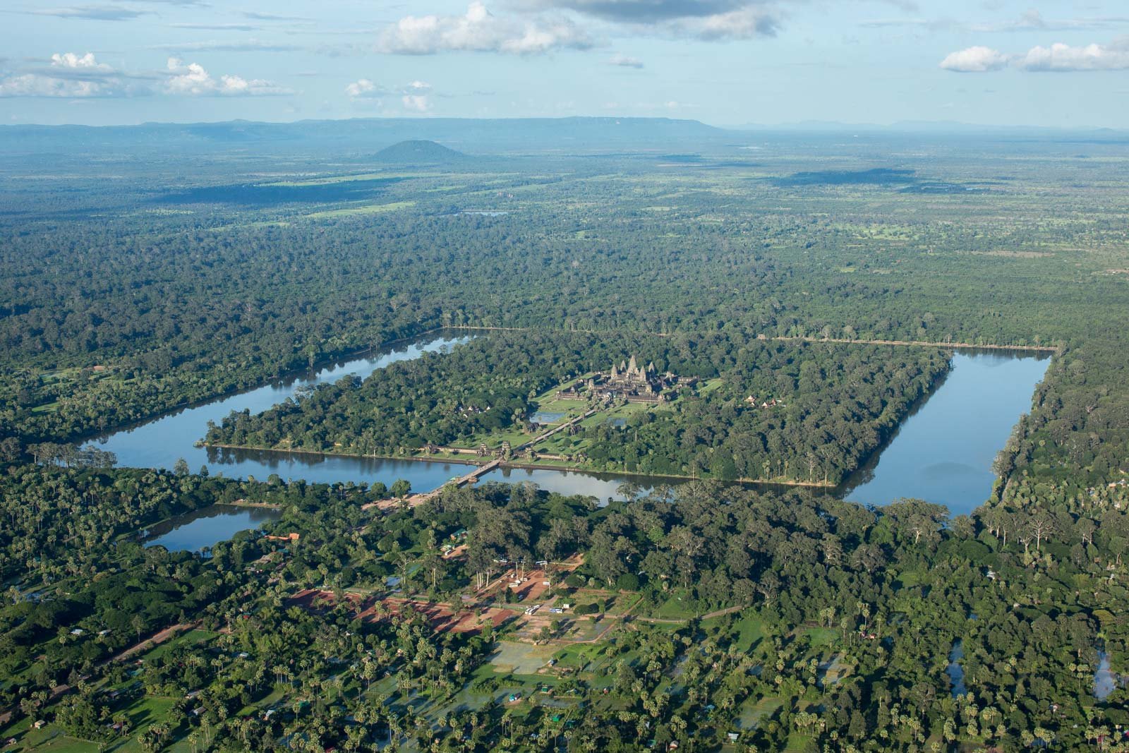
Angkor is known as the world’s first megacity and a hydraulic city. According to Evans et al. (2007), the area of Angkor’s urban complex was around 900 to 1,100 square kilometers, which is over four times the size of modern-day New York City. Angkor was a low-density city with dwellings and water tanks scattered over the region and linked by roads.
Between AD 800 and 1400, the Angkor civilization, also known as the Khmer Empire, was a powerful kingdom in Southeast Asia. It was notable for its vast water management system, which stretched over 1200 square kilometers (460 square miles) and connected the natural lake Tonle Sap to large man-made reservoirs (called baray in Khmer) via a series of canals, drastically altering the local hydrology.

The Khmer canal system connected into permanent water sources such as lakes, rivers, groundwater, and rains. Southeast Asia’s monsoonal climate divided the year into rainy (May-October) and dry (November-April) seasons. The region receives 1180-1850 millimeters (46-73 inches) of rain per year, with the majority falling during the rainy season.
Tonle Sap is one of the most prolific freshwater ecosystems in the world due to the Mekong River’s periodic flooding. Groundwater can be accessed at Angkor at ground level during the wet season and 5 meters (16 feet) below ground level during the dry season.
Water techniques utilised by the Angkor civilization to cope with the significantly shifting water quantities included placing their buildings on mounds or stilts, creating and dredging tiny ponds at the family level and larger ones (named trapeang) at the village level.
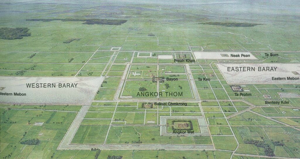
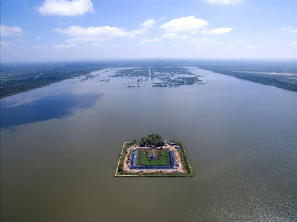
Most trapeang were rectangular and generally aligned east/west: they were associated with, and maybe governed by, temples. Most temples also had their own moats, which were square or rectangular and oriented in the four major directions.
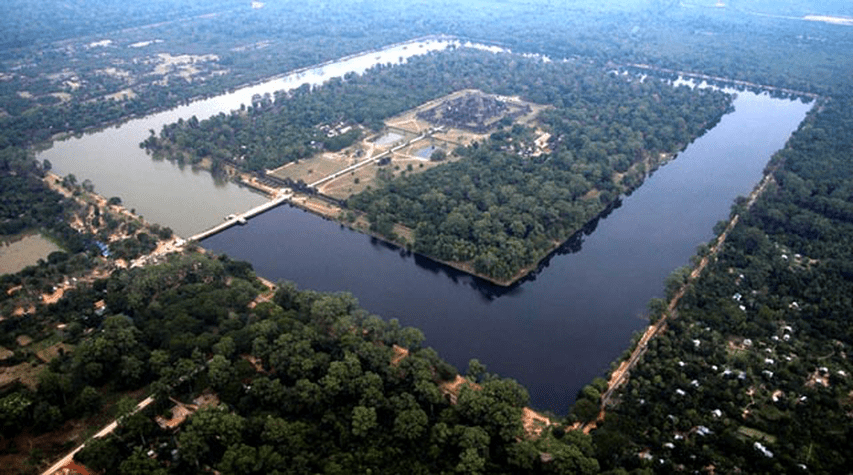
Large reservoirs, known as baray, and linear channels, roadways, and embankments were utilised to regulate water at the city level, and they may have created an intercommunication network as well. Today, there are four major baray in Angkor: Indratataka (Baray of Lolei), Yasodharatataka (East Baray), West Baray, and Jayatataka (North Baray).
They were very deep, 1-2 meters (3-7 feet) below ground level, and 30-40 meters (100-130 feet) wide. Baray were constructed by constructing earthen embankments 1-2 meters above ground level and feeding them with natural river channels. Embankments were often used as roads.
Geographic studies of the existing and former systems at Angkor reveal that Angkor engineers built a new permanent catchment area, resulting in three catchment areas when there were previously only two. The artificial canal ultimately flowed downward and became a river, altering the region’s natural hydrology.